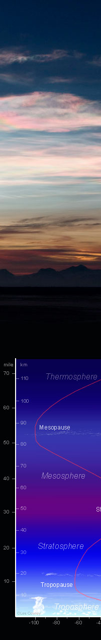
Nearly all our clouds are confined to the lower atmosphere, the troposphere.
Two rare types of cloud are seen at higher altitudes. Both occur at, or near, temperature minima.
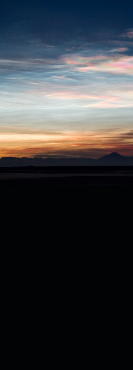
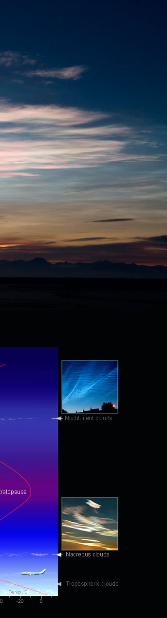
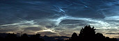
The highest are noctilucent or ‘night shining’ clouds at 80-85 km high (50-53 mile) and at a temperature of less than -123°C. They are composed of extremely small ice crystals, too small to show iridescent colours
The lower (and rarer) clouds are PSCs (Polar Stratospheric Clouds) and colourful nacreous clouds are a particular variety of them. They are 15 - 25 km (9 -16 mile) high in a temperature minimum between the warmer and lower troposphere and an increasingly hot stratosphere heated from the absorption of solar UV radiation by ozone.
PSCs need temperatures of less than -85°C to form and so are confined to high geographic latitudes and winter. They also need water vapour and can therefore be associated with very stormy conditions or downstream of mountain ranges when vapour is lofted up from the troposphere.
PSCs can be of exotic composition. Nacreous clouds are of friendly ice crystals but others are droplets or crystals of nitric and sulphuric acid compounds.
Nacreous clouds are the most colourful of the PSCs. On the night side of twilight they blaze with colour as though electrically lit. The colours are iridescence caused by diffraction from the many small ice crystals. Nacreous clouds are wave clouds and if you are fortunate to see them, watch for as long as possible to see their filmy shapes slowly curl and uncurl in the upper atmosphere winds and waves.
Once seen they are unforgettable. |