|
|
|
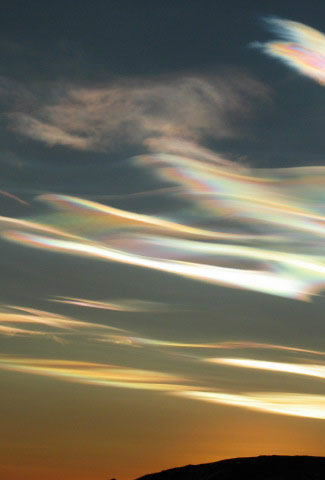
Nacreous
Clouds over Antarctica Imaged by Cherie Ude at McMurdo Base in
2004.
Nacreous clouds (Type II PSCs) glow brightly with vivid iridescent colours.
They are wave clouds and their undulating sheet-like forms reveal
the winds and waves of the stratosphere.
©Cherie Ude, shown with permission.
|
|
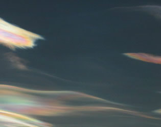
Nacreous
clouds, sometimes called mother-of-pearl clouds, are
rare but once seen are never forgotten. They are mostly visible
within two hours after sunset or before dawn when they blaze
unbelievably bright with vivid and slowly shifting iridescent
colours. They are filmy sheets slowly curling and uncurling,
stretching and contracting in the semi-dark sky. Compared with
dark scudding low altitude clouds that might be present, nacreous
clouds stand majestically in almost the same place - an indicator
of their great height.
They need the
very frigid regions of the lower stratosphere some
15 - 25 km (9 -16 mile) high and well above tropospheric
clouds. They are so bright after sunset and before dawn because at
those heights they are still sunlit.
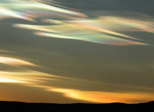
They are seen mostly during winter at high latitudes like Scandinavia, Iceland,
Alaska and Northern Canada. Sometimes, however, they occur as far south as England. They
can be less rare downwind of mountain ranges. Elsewhere their appearance is often
associated with severe tropospheric winds and storms.
Nacreous or ordinary iridescent clouds? Lower level iridescent clouds in the troposphere are far more common and are seen all over the world. Nacreous clouds far outshine them and have much more
vivid colours. The differences are highlighted on this page. |
|
|
|