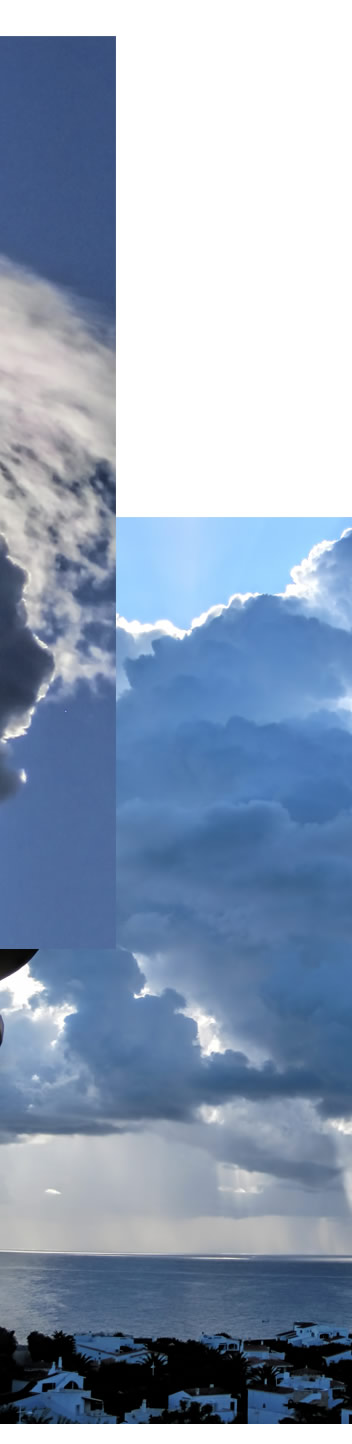
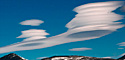
The story of thin and translucent pileus (cap cloud) starts with the development of lower and much thicker cumulus on a hot and humid day.
Warm air rises from sun heated ground. It expands and cools as it climbs. If its humidity is sufficient then moisture condenses out to form cumulus cloud. As the day proceeds the cloud grows upwards with yet more condensation. The condensation releases heat which accelerates further the upward motions in the unstable mass. In extremis we get a thunderous cloud mass towering several kilometres.
All this also pushes the air layers above the cloud tops upwards. If a layer is moist then the upward travel causes expansion, cooling and sudden condensation into a thin cloud of droplets - a pileus cloud.
The rapid condensation into pileus is important. The droplets are all of similar size and do not have time to evolve. Ideal material to diffract the high altitude sunlight into bright iridescence.
|