|
|
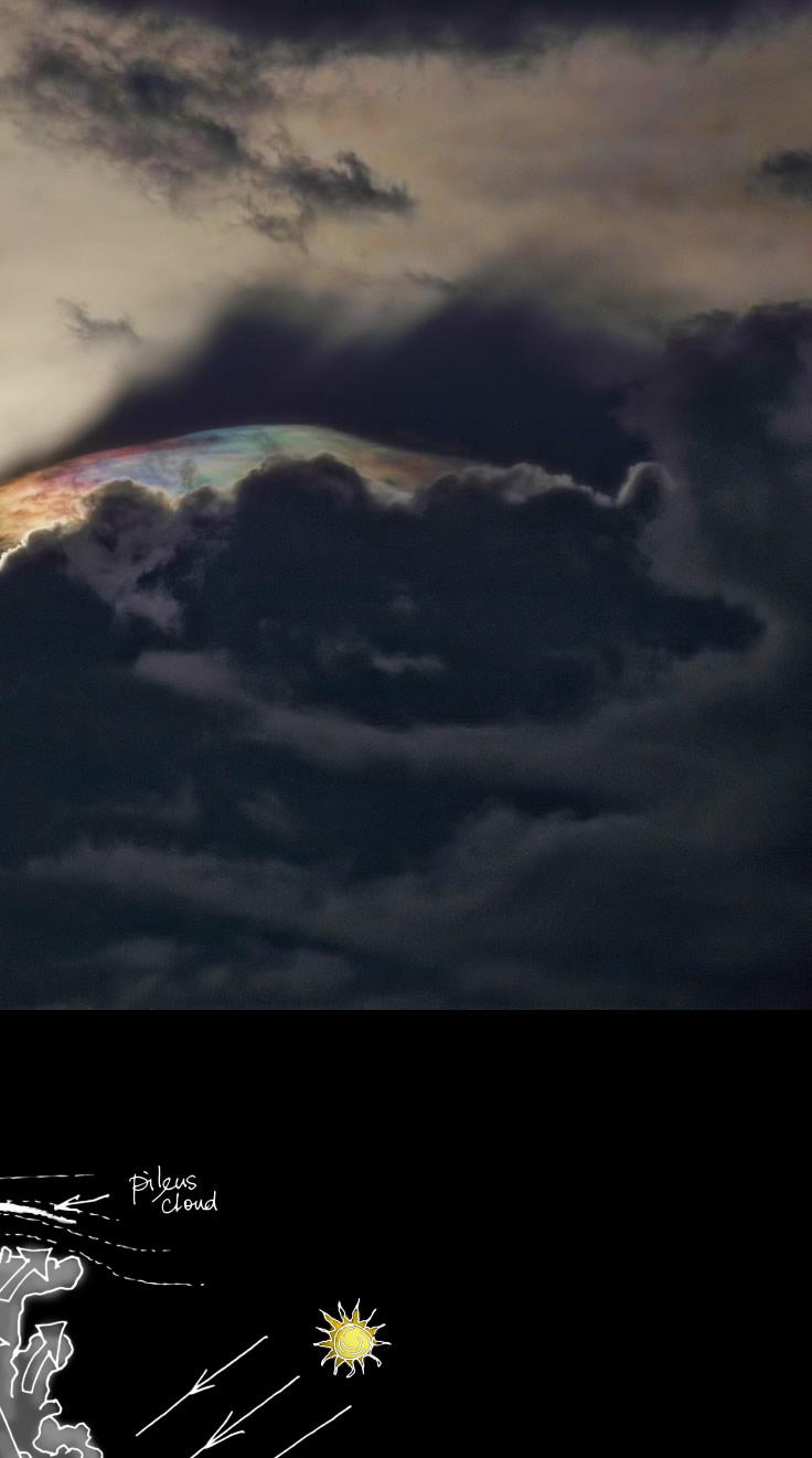
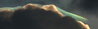
| Iridescent Pileus & Shadows Captured by Dávid Hérincs. "It was a warm, muggy day and the air was very unstable. A thunderstorm with iridescent pileus formed late afternoon near my village of Egyházasrádóc, Hungary. The iridescence was visible only 1-2 minutes, so I was very lucky to see it." ©D�vid�H�rincs, shown with permission |
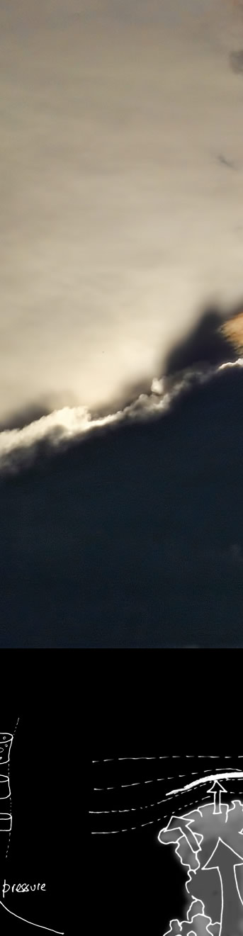
The story of thin and translucent pileus or cap cloud starts with the development of lower and much thicker cumulus on a hot and humid day.
|
A ragged shadow extends upwards and to the right of the cloud tops. All is not what it seems. The downward sun rays cast the shadow onto a lower layer of thin cloud. To the eye it looks as though the shadow is above the upper cloud. |
|
|

| About - Submit | Optics Picture of the Day | Galleries | Previous | Next | Today |
      |
| Air pressure decreases with height. An ascending isolated pocket of moist air expands and adiabatically cools because expansion requires work to be done against the surroundings. With sufficient cooling some of the pocket's water vapour condenses out into small droplets |