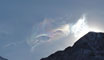
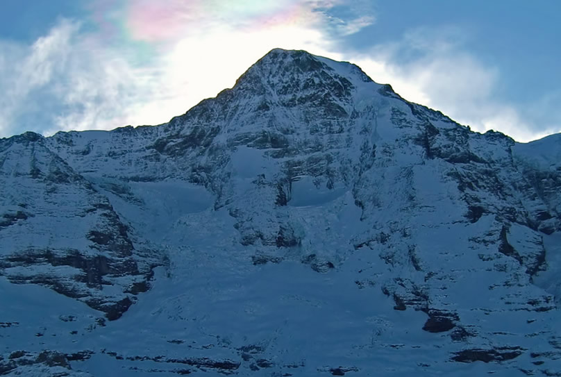
Banner clouds are so named because they appear like banners attached to mountain peaks. They can also resemble snow blowing off the upper mountain slopes.
They are not entirely understood but are essentially the result of wind flow around the peak. The flow produces a lower pressure on the lee (downwind) side. This in itself can cause some adiabatic cooling and cloud formation similar to that induced near an aircraft's wings and fuselage.
There is, however, an additional mechanism. The pressure drop, increasing with height, induces airflow up the lee slope from lower down the mountain. The upward flowing air expands and cools as it climbs. If the air near the mountain base is moist then some of its water vapour can condense near the peak to form the banner cloud.
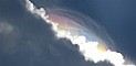
Rapidly formed thin clouds are ideal for iridescence. The individual water droplets scatter sunlight primarily from their periphery. The outgoing scattered waves overlap and interfere to eventually form brightness in some angular directions and darkness in others.
But that is for monochromatic light. Irradiate droplets with white light and some of the colours are enhanced and others weakened. The interference pattern also depends on the droplet size. 'Old� clouds have a sufficiently wide range of sizes that the interference colours overlap to give no net coloration. In contrast, when clouds form rapidly the droplets are relatively mono-sized and we see the colours.
|