|
 |
 |
 |
 |
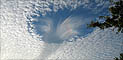
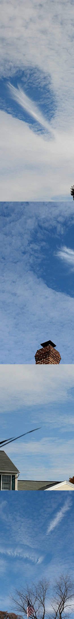
| Multiple Hole Punch Clouds seen a few days ago in Pennsylvania by Linda M. Sweger. All images �Linda M Sweger, shown with permission. |
|
|
|
|
|

| About - Submit | Optics Picture of the Day | Galleries | Previous | Next | Today |
| The 'punch' that made these cloud holes was rather irregular and was applied many times. The alto- cumulus cloud layer had many holes and more were forming – see the lowermost images. ‘Hole punches’ often have ice crystals, virga, streaming from them. The crystal virga even form halos proving that the crystals are large. Hole punches are thought to result from an instability that causes supercooled droplets already in the altocumulus to suddenly transform into large ice crystals. The larger ice crystals fall and are in any case are less opaque – we therefore see a hole. A trigger might be other ice crystals tumbling downwards from a higher cirrus cloud that act as nuclei – seed crystals. Supercooled droplets? Water does not always freeze at 0 degrees Celsius. If no nuclei are present on which ice crystals can grow, the cloud water droplets cool to sub-zero temperatures. But that is a metastable condition because ice is the more stable state. Introduce enough nuclei or otherwise disturb the cloud and ice crystals grow very rapidly. This is a normal state of affairs. Rain can form that way from an initial formation of ice crystals coagulating into larger snowflakes which subsequently melt as they descend. What is strange is that the supercooled droplet to ice transformation should take place in small patches to form hole punches. Several hypotheses exist to explain the necessary localised disturbance but none are proven. |