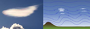
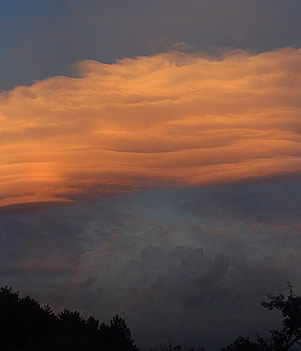
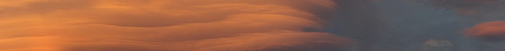
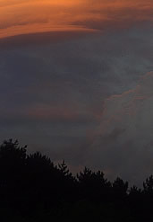
The multilayered lenticular cloud lit by the reddened rays of a low sun dominates the sky. Light from it gives a thin red lining to the lower and nearer cumulus at far right.
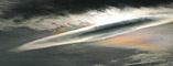
The connection with atmospheric optics? Lenticular clouds are famous for vivid iridescent effects. They arise from the special properties of the clouds' droplets.
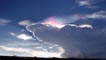
Lenticular clouds appear more or less stationary in the sky but air is rushing across them. They are wave clouds formed on the upper parts of atmospheric waves in the lee of mountains or some other meteorological disturbance.
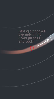
A pocket of air rising with one of the waves expands as it is forced to ascend. There is no transfer of heat and the expansion is therefore adiabatic. The work done in expanding is at the expense of the pocket’s heat content and thus the air temperature falls. When the cooling is sufficient, water vapour condenses into a host of small, fresh droplets and this marks the upstream edge of the lenticular cloud. Seconds later the air pocket, now laden with droplets, starts to descend with the wave. The pocket is compressed and its temperature increases again. The droplets evaporate - end of cloud.
Lenticular clouds are very dynamic objects marking the crests of atmospheric waves and the boundaries of droplet condensation and evaporation.
Optics? The cloud droplets have no time to evolve by coalescence or preferential evaporation of small ones to feed larger droplets. The droplets are nearly mono-sized. Mono-sized droplets give vivid iridescence. The monsters pictured here are too large and optically thick to show iridescence, smaller thinner lenticulars are best.
|