| Circumhorizon Arc & Mount Rainier |
|

|
|||||||||||||
|
|||||||||||||
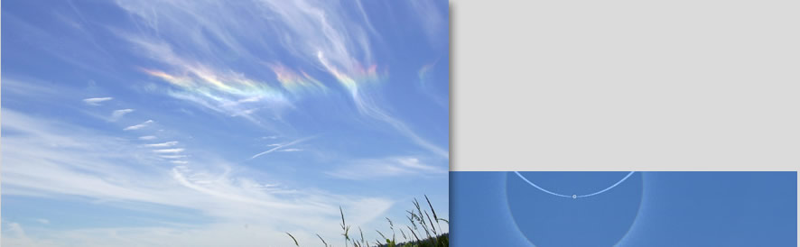
| Circumhorizon arc and Mount Rainier. Caught by David Johnston in wispy cirrus over Duvall, Washington State on 3rd July 2001, solar altitude 65°. Mount Rainier is at the lower left. |
The HaloSim simulation at right shows how far the arc would spread if the sky were uniformly covered by cirrus cloud. containing well formed plate oriented crystals. David Johnston's image is 41° wide but the full extent of the CHA is some 100° depending on the solar altitude. Some randomly oriented crystals were included in the simulation to produce the reference 22° radius halo above the CHA. The camera projection makes the CHA appear to curve upwards from the horizon. It is actually everywhere at the same height. |